

GPS PLOTTER+FISH FINDER (8″/10.4″/15.1″) – SAMYUNG N800/NF800/N5100/NF5100/N3800/NF3800
The best unit with all the basic functions that a plotter requires , Powerful CPU !! The best chart !! Elegant design !! Perfect service !!
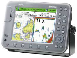
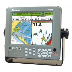
N800/NF800
N5100/NF5100
N3800/NF3800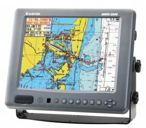
Features
• High density display with High resolution TFT LCD
• 10 steps adjustable LED backlight
• NAVIONICS GOLD using SD card
• 128MB internal memory and built-in standard Samyung chart
• Individual button for navigation GOTO and MOB
• NMEA(0183) interface (AIS, NAVTEX, DSC etc.)
• Multiple languages available including English, Chinese Russian, etc.
• DGPS (WAAS, MSAS, EGNOS)
• User friendly icon menu method allows outstanding user interface
• Perfect navigation ability when connected to the Auto steering/ engine control
• Dual frequency (50/200Khz) strengthen detection of small and individual fish (NF800/5100/3800)
• Upgraded Auto range, gain, output and pulse length with latest digital fish finding circuit adopted.
• Use of high performance (AIRMAR) transducer allows detection of small and individual fish (NF800, 5100, 3800)
Specifications
▶ N800 / N5100 / N3800
• Size : 8”(640 x 480 pixels) / 10.4”(800 x 600 pixels) / 15.1”(1024 x 768 pixels)
• Display : 16 Channels 16 Satellites / Digital 16 Channel multi tracking type
• Supply voltage : 10 to 32 V DC Approx. 40W
• Operating temp. : -10℃ ~ 50℃
• Display mode : normal, true-motion, course-up, northup, head-up function
• Alarms : Arrival radius, anchor, XTE, danger, too shallow, too deep, fish, temperature, temperature rate,
low battery, low fuel(optional), loss of DGPS fix, radar guard zone, dangerous AIS vessels.
• Chart/User card : NAVIONICS GOLD / SD Card
• Waypoints : 10,000 waypoints (Event Mark : 48, Mark Color : 16)
• Routes : 100 Routes, with up to 100 points each
• Tracks : By time or distance, 10 track of 15,000 points
• Chart datums : 216 Chart datums(1/2000~1/37,500,000)
• Chart scale : 0.2 ~ 500 nm
• Interface : NMEA 0183
▶ DISPLAY UNIT
• Size : 8”(640 x 480 pixels) / 10.4”(800 x 600 pixels) / 15.1”(1024 x 768 pixels)
• Display : 16 Channels 16 Satellites / Digital 16 Channel multi tracking type
• Supply voltage : 10 to 32 V DC Approx. 40W
• Operating temp. : -10℃ ~ 50℃
• Display mode : normal, true-motion, course-up, northup, head-up function
• Alarms : Arrival radius, anchor, XTE, danger, too shallow, too deep, fish, temperature, temperature rate,
low battery, low fuel(optional), loss of DGPS fix, radar guard zone, dangerous AIS vessels.
• Chart/User card : NAVIONICS GOLD / SD Card
• Waypoints : 10,000 waypoints (Event Mark : 48, Mark Color : 16)
• Routes : 100 Routes, with up to 100 points each
• Tracks : By time or distance, 10 track of 15,000 points
• Chart datums : 216 Chart datums(1/2000~1/37,500,000)
• Chart scale : 0.2 ~ 500 nm
• Interface : NMEA 0183
• Frequency : 50/200KHz
• Output : 600W
• Depth Range : 5m~1,500m
• Color Display : 16 colors
• Brightness : 10-step
• Screen Moving Speed : super fast, fast, medium, low, stop
• Battery Voltage Display : Voltage number dispaly
• AUTO GAIN Adjustment : OFF/ON
• A-Mode Display : OFF/ON
• Demo Dispaly : OFF/ON
• Weak Color Removal : 0% ~ 75%